Web browser GPS visualiser
This is a visualisation tool of GPS files that is run in the web browser.
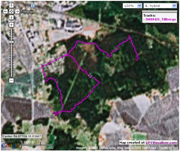
The GPS tracks readerHistorical maps of Sweden
Look at airial maps of Sweden year 1960 or 1975.
Kartbild.comThe start 2007
Hans' radio-orienteering friend Rolf Svensson started it; tracking the path during a radio-orienteering competition. And, since Hans got a GPS unit for his 50th birthday in 2007 he started to use it also.
A great way to inspect the tracks is by uploading them to GPS Visualizer.
Another alternative is comparetracks.com. See the radio-orienteering night race of Hans, Jan and Rolf, August 2008 in Eskilstuna:

GPS devices and file formats
Hans first GPS; Garmin eTrex Venture® Cx, had the capability of saving the track data as GPX files directly.
The second GPS; Garmin Forerunner ® 405, did not stored the tracks in GPX format but the TCX format, which is basically a GPX file with added information like heart rate and distance.
One month in 2017
This calendar shows the GPS-tracks that Hans created in May 2017.

Track animations
With the track files and map data it is possible to create animations of the path.
Here are some animations of GPX track files.
Sport events
2009-05-29: ![]() Radio-orienteering, Lindesberg, 3,5 MHz
Radio-orienteering, Lindesberg, 3,5 MHz
2014-02-21: ![]() Kortvasan 30 km, Mora
Kortvasan 30 km, Mora
Recreation events
2012-07-28: ![]() Torpedo boat HMS Spica T121, Stockholm
Torpedo boat HMS Spica T121, Stockholm
Difference between the GPX and TCX file format
GPX and TCX are both XML file formats. Both contain GPS waypoints, tracks, routes, etc.
GPX is an open format, free for development use without licenses.
TCX is a proprietary format developed by Garmin. It allows additional information such as heart beat and cadence.
A trackpoint from a GPX file
<trkpt lat="59.6500974" lon="16.5200726">
   <ele>39.5512695</ele>
   <time>2009-03-21T07:14:50Z</time>
</trkpt>
The same trackpoint from a TCX file
<Trackpoint>
   <Time>2009-03-21T07:14:50Z</Time>
   <Position>
      <LatitudeDegrees>59.6500974</LatitudeDegrees>
      <LongitudeDegrees>16.5200726</LongitudeDegrees>
   </Position>
   <AltitudeMeters>39.5512695</AltitudeMeters>
   <DistanceMeters>1534.3891602</DistanceMeters>
   <HeartRateBpm xsi:type="HeartRateInBeatsPerMinute_t">
      <Value>151</Value>
   </HeartRateBpm>
   <SensorState>Absent</SensorState>
   <Extensions>
      <TPX xmlns="http://www.garmin.com/xmlschemas/
      ActivityExtension/v2" CadenceSensor="Footpod"/>
   </Extensions>
</Trackpoint>
FIT file format
| Data | FIT | TCX | GPX |
|---|---|---|---|
| GPS position | yes | yes | yes |
| Heartrate | yes | yes | – |
| Cadence | yes | yes | – |
| Speed | yes | yes | yes |
| Distance | yes | yes | yes |
| Power | yes | yes | – |
| Temperature | yes | – | – |
| Heart rate variability | yes | – | – |
| Pool Swim | yes | – | – |
| Open Water | yes | yes | – |
| Weather Conditions | yes | – | – |